
Walk an Euless Street by Address
An address search in Euless has a useful order. The Tarrant Appraisal District, usually called TAD, supplies the current appraisal card. The county map then helps place that card among nearby parcels. From there, the legal description can bridge into recorded instruments, and city reports can add dates for physical work. This sequence identifies public property and recorded-party evidence. It does not turn an address into a complete household list, so each result needs its source and date noted.
- Enter the full site address in TAD and copy the account number, geo-reference, situs address, current owner field, mailing address, and legal description.
- Use the Tarrant County Public Map Viewer to check parcel lines, city limits, and available layers around that site.
- Keep the property location and the owner mailing address in separate worksheet fields. They can match, but neither one alone proves occupancy.
- Search the legal description, indexed parties, subdivision, or document number in the Tarrant County Official Records Search to locate the latest recorded conveyance.
- Use a permit report, a voter record for a specific person, or a historical reverse directory only for the narrower question each source can answer.
For a single address, this trail is more reliable than a broad name search because the parcel remains the common reference even when a street label is abbreviated differently. Note: the clerk does not assemble a title chain for patrons, so a researcher must compare the instruments and legal descriptions personally.
Euless Parcel Search Fields
TAD and the Tarrant Tax Office serve different roles in an Euless street directory search. TAD displays appraisal information, including the property address, current owners, mailing address, legal description, account and geo-reference. The tax search is a separate weekly updated roll. Its official instructions call for a search type, account type, inactive-account choice, pay-status choice, security check, and query. Use the field that matches the information already in hand rather than forcing an address into an owner-name field.
| Portal field | Input | Use for an Euless address |
|---|---|---|
| TAD property type | Search selector | Sets the kind of property search before entering a term. |
| TAD search term | Text | Starts a generic property search; review the detail card for account and legal-description fields. |
| Tax Property Location | Text | Enter the street number and street name, omitting the street type and direction under the county instructions. |
| Tax Owner Name | Text | Use last name with first name or initial when the address is not producing a result. |
| Tax Account Number | Text | Use the account identifier from the appraisal result; leading zeroes may be omitted. |
The Tarrant Tax Office search is shown in the official capture below. It offers Account Number, Owner Address, Owner Name, and Property Location choices, not a documented whole-street browser. A result is a tax-roll clue, not proof that every name associated with the parcel lives there.
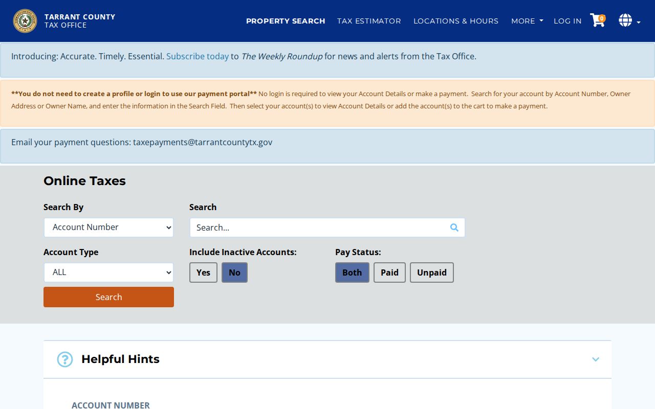
Use the control labels to normalize an Euless address before comparing it with TAD or GIS. Small differences in directions and street types can otherwise hide the same parcel across county systems.
Map Euless Streets as Parcels
The county viewer accepts Address, Account, and Owner inputs, as well as an address-entry prompt. Its Layer List gives geographic context, while links to TAD and Voter Lookup lead to the records systems that supply the underlying information. Use the map to locate a parcel and compare streets, city limits, and available layers. The available research did not verify a radius tool, a next-parcel button, or a guaranteed street-wide export, so do not assume those controls are present during a live session.
Euless Map Atlas adds ownership leads, zoning, survey data sheets, plats, and aerial imagery. Its City Limit Line Index ties segments to ordinances. That city layer is especially useful where a named Euless street approaches another jurisdiction. Parcel-map ownership remains a lead; recorded title should be confirmed through the County Clerk.
The following capture links to the Tarrant GIS Property Search, where the Address, Account, Owner, search, and layer controls were observed.
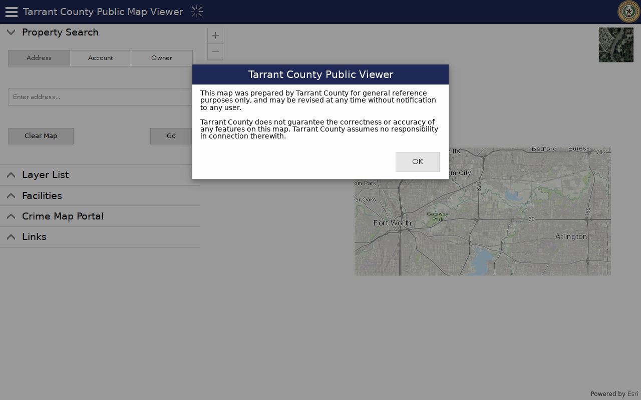
After the map centers on an Euless site, carry the account or legal description to TAD and the deed index. The map makes the geography clear; it does not replace the property record or the recorded instrument.
Separate Euless Address Labels
One of the most useful checks in street-by-street research is also a simple one: copy the situs and mailing addresses into different columns. The situs address is where the parcel sits. The mailing address is where the appraisal district sends correspondence. A mailing address may be an office, family address, or another property. The legal description is a third layer, usually a subdivision, block, lot, survey, or metes-and-bounds reference, and it is the form deeds often use.
| Situs address | The physical Euless property location used by parcel, permit, and code records. |
|---|---|
| Mailing address | The correspondence address on the appraisal record, which may be elsewhere. |
| Legal description | The land identifier used to join plats, appraisal records, and deed-index results. |
| Geo-reference | A TAD map-related identifier that helps distinguish a parcel from a similarly numbered site. |
- Parcel
- A mapped piece of land with its own appraisal and legal-reference trail.
- Plat
- A recorded map that can show subdivision lots, blocks, boundaries, and access details.
- Criss-cross directory
- A historical directory arranged by address, used to find an occupant or business listed at a site in that edition.
- Metes and bounds
- A legal-description method that describes land through bearings, distances, and boundary calls rather than a numbered lot.
This distinction is the local insider check for an Euless street directory: a property owner, a mailing destination, and an occupant are not interchangeable roles. Exemption information may be consistent with owner occupancy, but it remains inconclusive and should be dated.
Trace Euless Deeds by Legal Description
The appraisal card becomes a deed-search bridge when the legal description is copied exactly. In Official Records Search, the observed Search Term placeholder accepts grantor or grantee, subdivision, document type, or document number. Recorded Date supports a range, and the portal offers index-only and index-plus-OCR choices. Search both buyer and seller names, initials, abbreviations, and the subdivision before deciding that a record is absent.
A grantor is the party transferring an interest. A grantee is the party receiving it. Start with the latest conveyance, record the buyer, seller, recording date, document number, and legal description, then search the seller as an earlier grantee. A deed can document a recorded party and land interest. It does not establish who occupied the address.
This capture links to Tarrant County Official Records Search. The free index and paid copy route answer different questions, and the result fields should be recorded before requesting an image.
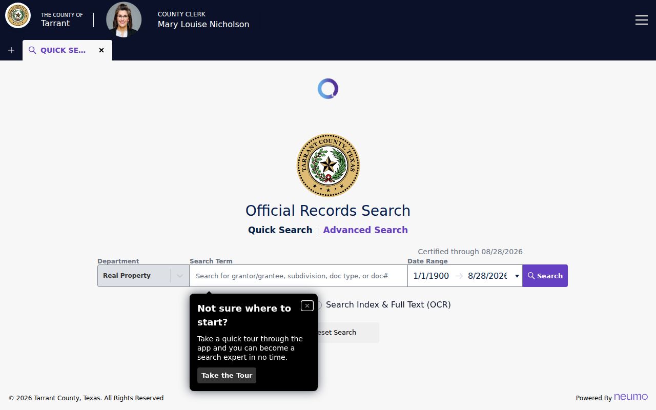
An unofficial watermarked image is available after registration or sign-in, while certified copies are paid through the portal, by mail, or in person. The Clerk generally provides in-person copies in Room B30 for $1 per page plus $5 certification; use the official copies instructions to confirm current terms.
Read Euless Permit Reports by Site
Euless permit and certificate-of-occupancy reports add a dated construction layer to a property trail. Their reported fields include issue date, permit number, type, site address, contractor, fees, description, and valuation. That makes a permit useful for dating a construction, alteration, or inspection sequence. It does not show that a contractor owned the property or that a person lived there.
Code Compliance is also keyed to an address, but the city did not expose a public searchable case database in the research. For a dated case at a specified location, use the city reporting route or make a Texas Public Information Act request to Euless. The city says Planning and Economic Development is transitioning forms to a Cityworks self-service portal in 2026, although the exact go-live date and remaining legacy forms were not stated.
Note: a gap in a permit or inspection sequence does not establish that no work occurred, especially when the record type or access channel changed.
Check Euless Street Boundaries
A street name and a ZIP code do not settle municipal jurisdiction. Euless maps provide a City Limit Line Index and plats for boundary questions, while county GIS shows parcel and road context. The city states that ZIP codes 76039 and 76040 serve Euless, yet a small Fort Worth area immediately south of Euless also uses 76040. For an address close to a line, retain the postal ZIP, delivery city, and municipal jurisdiction as separate labels.
Older street research can be harder still. Local sources name Main Street, Ector Drive, Cullum Drive, County Line Road, Hall-Johnson Road, Glade, Oak Lane, Trailwood, Calloway, and Mosier Valley, but no official citywide renumbering table with effective years was found. Search legal descriptions and plats when street text does not carry across an older deed, directory, or map.
Boundary check. A ZIP can describe mail delivery while an Euless city-limit map describes jurisdiction, so compare both before drawing a residency conclusion.
Euless Street Records by Address
Each source in an Euless street directory answers a narrower question than the next. TAD is the starting card for owner, mailing, situs, value, and legal-description data. The tax roll supplies account and payment context. Maps clarify parcel geometry. The Clerk index supplies recorded parties and instruments, while permits date work at the site. Put the source role beside each result so an ownership record is not read as a household roster.
| Address record | Local custodian | Street-level clue | Access route |
|---|---|---|---|
| TAD appraisal card | Tarrant Appraisal District | Current owner, situs, mailing address, value, legal description | Free web search; historical coverage not stated |
| Tax account | Tarrant Tax Office | Account, owner or address, payment status | Free web search; current roll uploaded weekly |
| Parcel map | Tarrant County and Euless GIS | Parcel shape, boundary, map references, layers | Public viewer; selection controls need live verification |
| Deed, plat, or easement | Tarrant County Clerk | Recorded parties, instrument, legal description | Free index; copy routes have fees |
| Deed History Card | Tarrant Tax Office | Historical property-tax and ownership research | 1876-1984 |
| Permit report | Euless Planning | Issue date, site, contractor, project, valuation | Period reports; not occupancy proof |
| Code case | Euless Code Compliance | Address-based violation workflow | Report or request route; no public search located |
| Voter record | Tarrant Elections | Registration status, precinct, district for a named person | Person lookup; full-file use is regulated |
The historical fallback is the Tarrant County Archives, which accepts walk-in research Tuesday through Friday from 9:00 a.m. to 4:30 p.m. and appointments on Monday. Its deed and property context can help when the current online index does not state an online cutoff for the document class needed.
Use Euless Voter Evidence Carefully
The Tarrant Voter Lookup is designed for a specific registration search. Its observed form uses Last Name, First Name, DOB, or State Voter ID, plus an address, ZIP Code, or location option for election information. A match can show registration and district information, including address, status, precinct, and city council fields. It does not show ballot choices.
It is not an open street browser. Texas Election Code Section 18.008 provides a statutory route for voter-list copies, subject to protected-voter omissions and the required process. Section 18.009 restricts promotional use. A missing result can reflect a protected voter, a changed address, or no matching registration; it cannot establish the number of people at a property. When the question is historical rather than current, the Euless city directory collections provide the more fitting address-oriented lead, and each volume's scope should be checked before relying on an entry.
Euless Street History Has Gaps
The best street trail sometimes leaves the web. Tarrant County records include a documented historical land path from 1876 forward, but the current Official Records Search does not publish a single beginning year for every document class. Deed History Cards reach 1876-1984, and the Archives holds historical books and ledger context. Older addresses may also appear under rural Tarrant, Bedford-area, or community names because Euless incorporated in 1953 and adopted its charter in 1962.
The March 29, 1876 Old Courthouse fire destroyed pre-fire commissioners-court loose-paper records, and most pre-1876 marriage records were also lost. Later transcriptions, certified copies, and Archives ledgers are substitutes rather than an unbroken original run. Treat an online no-result as a reason to use the Clerk, Archives, or a request route, not as proof that a historic Euless address had no record.
Limits of Euless Street Searches
Public address records do not expose a complete list of non-owner occupants, household members, utility customers, delivery recipients, or motor-vehicle address data. Federal Driver's Privacy Protection Act rules restrict personal information from state motor-vehicle records. A deed party is not necessarily an occupant, a permit contractor is not necessarily an owner, and an appraisal mailing address can belong elsewhere.
Keep a compact research worksheet for each parcel: normalized address, USPS ZIP, municipality from the city-limit map, TAD account and geo-reference, situs and mailing addresses, legal description, owner field as displayed, latest deed document and date, permit dates, and source URL with check date. That preserves the evidence needed for property, family-history, heir, or civic questions without turning public records into an unsupported people list.
Lawful use. Euless street and property records support personal, lawful research. Do not use address information to stalk, harass, intimidate, or harm anyone.